In preparing the illustrative layout for the site, Taylor Wimpey’s consultant team have considered the landscape, drainage features, topography and local context of the site.
The following plan shows some of the features and constraints that have informed the emerging outline proposals. Key features include topography with a valley running centrally south to north through the site, an existing public right of way crossing the site from east to west, existing hedgerows and trees with associated root protection zones, existing ponds and ecological habitats, neighbouring allotments and residential properties, and the nearby conservation area.
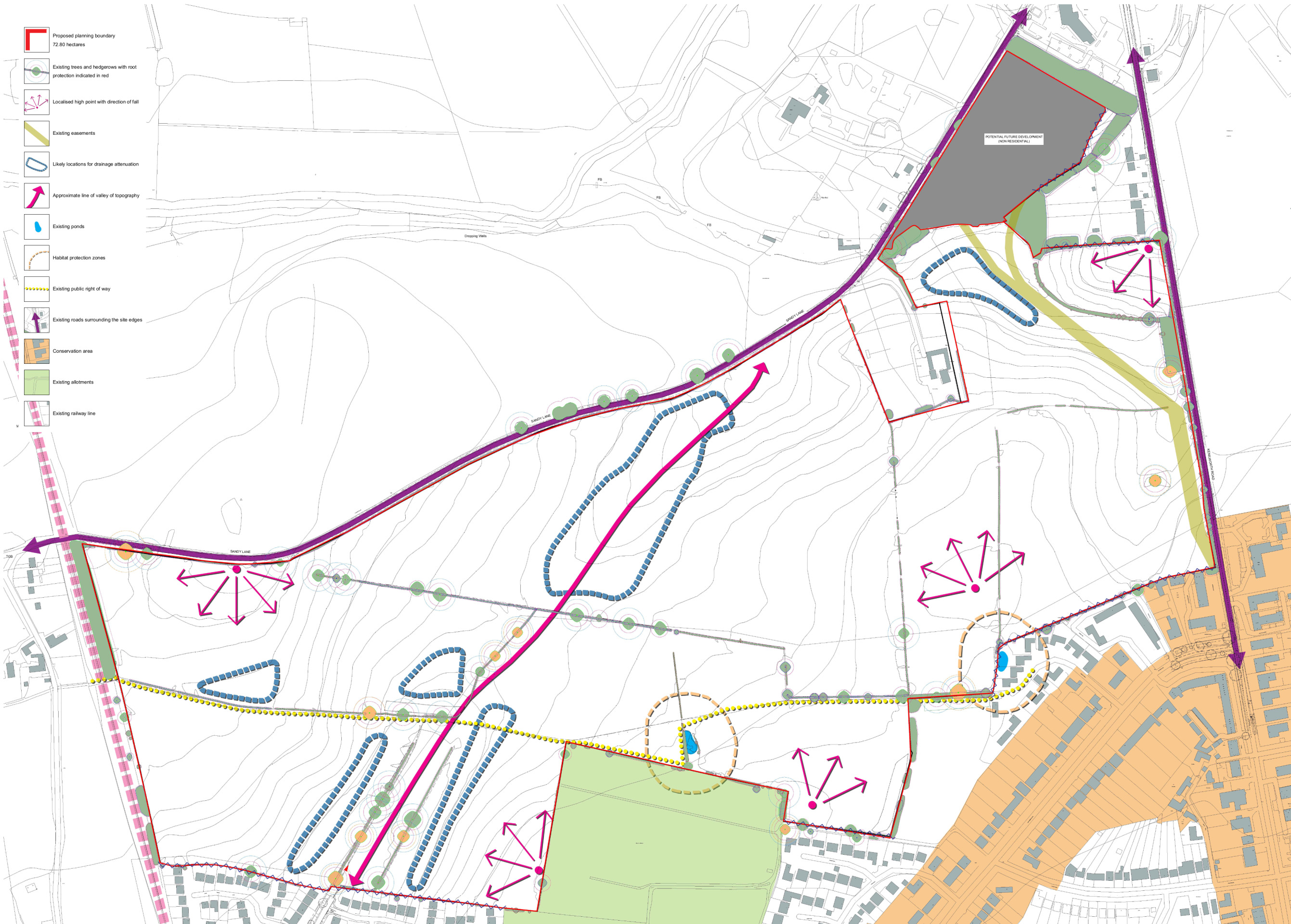
This plan shows an early analysis of some of the site features that have influenced the illustrative masterplan for the site - click to enlarge