Archaeology
Desk-based assessment, including analysis of local and online records, historic maps and aerial imagery, has identified that the site was most likely agricultural land for much of its past. Former field boundaries and remnants of ridge and furrow, evidence of medieval and post medieval ploughing are recorded within the site. A small area was used as a 19th century rifle range, shown on early OS maps.
Geophysical survey has been undertaken for the whole site. Apart from former field boundaries and ridge and furrow, no areas of significant archaeological activity have been identified. Some possible and uncertain anomalies were found, and these may have an archaeological, agricultural or natural origin.
Based on the known information, the site is considered to have low potential for archaeology. Discussions with the Local Planning Authority’s archaeologist will be held to agree an appropriate scope of more detailed evaluative works as the planning application moves forward.
Built Heritage
An initial assessment of built heritage has been undertaken to inform and shape the illustrative masterplan, and analysis is ongoing in this respect.
A number of designated heritage assets are located within 1km of the site, reflecting its proximity to the Royal Leamington Spa Conservation Area. Key assets include the conservation area itself, Guy’s Cliffe (comprising a Grade II Registered Park and Garden, Scheduled Monument, Grade II* Chapel of St Mary Magdalene and a number of Grade II listed assets), the Grade II listed Manor Farmhouse, and the Grade II* listed Church of St Mark. The design process is responding sensitively to the setting of these assets, including the use of landscaping to minimise visual impacts and to maintain important views.
Warwick District Council’s Local List of Heritage Assets identifies Jepson House to the north-east of the site within the 1km study area; however, it is not considered likely to be affected by the proposed development.
An analysis of historic mapping has also identified Sandy Lane Farm, to the north of the site, as a potential non-designated heritage asset. Further assessment is being undertaken to better understand its significance and to ensure that any potential impacts arising from development are minimised.
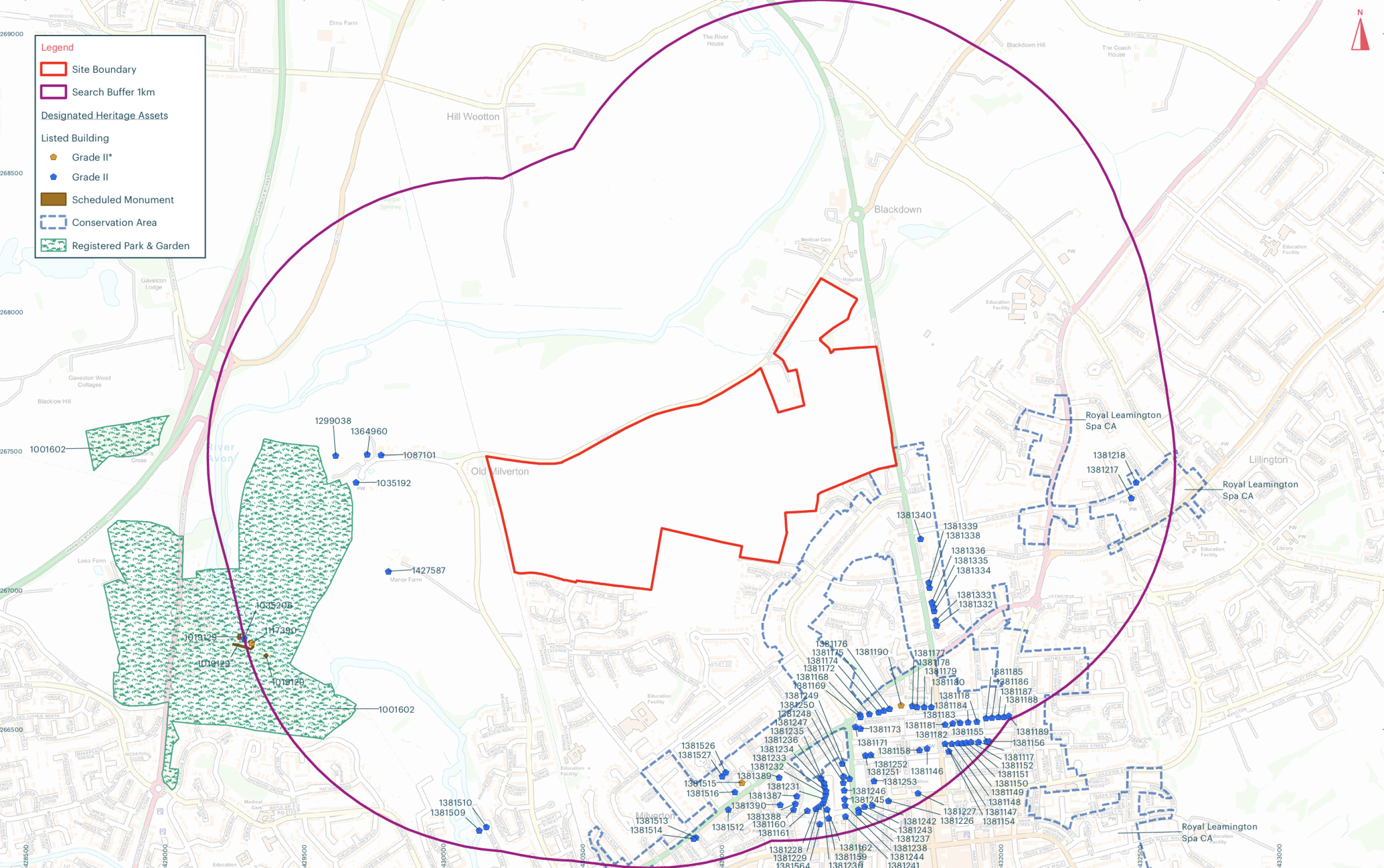
A plan showing designated heritage assets in the site vicinity, part of a suite of heritage and archaeological assessments - click to enlarge
Landscape
A Landscape and Visual Impact Assessment (LVIA) will be undertaken to inform our proposals and will be submitted as part of the outline planning application.
The LVIA will consider the effects of the proposed development on the landscape and visual resource. It will consider the degree of change to the existing landscape character and the potential effects of the proposed development on visual receptors. The iterative process will seek to design out any potential impacts where practicable while also seeking to unlock potential opportunities for wider positive environmental benefits.